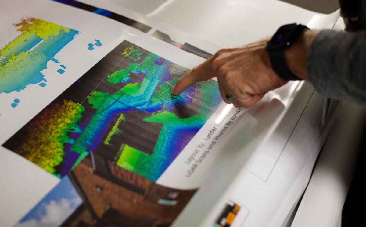
Brookhaven Geographic Information Systems students, with drones, tablets and scanners in hand, went from campus to campus creating detailed floor plans for over 5 million square feet of Dallas College buildings for the Facilities Department.
As of the Spring 2026 semester, the space management project is near completion after two years of developing floor plans for 108 Dallas College buildings. As a result, facilities now have updated information, including the size of the rooms, room usage and what kind of doors or windows are in the rooms.
The project was an $300,000 collaboration between Dallas College facilities and the GIS program. The initial funds were going to be spent on an external contractor, with the total cost estimated at around $3 million. Instead, about a dozen students were hired as paid interns, gaining class credit and real-world GIS experience while saving the college money.
Scott Wright, chief facilities officer at Dallas College, said he realized the need for floor plans after Dallas Community College District merged its seven colleges into one unified entity in 2020. “As we became one, there was no centralized place for all the floor plans,” Wright said. “They were all over the place. And they were outdated.”
As the project began in Spring 2023, Brookhaven GIS professor Scott Sires divided the work across his classes. Sires said the process was trial and error until the students had a proper process, proper data, standard operating procedures and training materials for other students.
By the summer of that year, students began collecting data using handheld Light Detection and Ranging, or LiDAR, scanners. They also filled out digital surveys for each of the rooms, manually inputting up to 64 specific room characteristics including room number, room name and window amount.
Kellie Wallace, Dallas College director of Space Management and Planning, supervised the interns during the project. Wallace said at the beginning, there was a learning curve using the new equipment and properly gathering data. “I’d say 99% of the time it was fine, but there were just a couple challenges,” Wright said.
“We just kept trying to do it right and figure it out,” Sires said. “And that’s a lot of what GIS is. It’s a really confusing kind of a puzzle.”
Wright said that though the project would have been completed sooner with an external contractor, the final product wouldn’t have been as good.
Because there is new construction and spaces being used for different things, Sires said there will always be a small volume of redoing data. However, much of the redo is now done by the facilities department as things change.
Looking forward, GIS students have another ongoing project mapping Chambers Memorial Cemetery, a historic Black cemetery in Cleburne, Texas. Sires said they are nearly finished with the project but will be working on capturing the oral history of the cemetery over the summer or fall.
Despite the projects, Sires said the GIS program’s enrollment is very low. “It’s so small, but it’s vital,” he said. “Not all value of a program comes only from tuition, paid enrollment, numbers.”